Showing posts with label maps. Show all posts

Monday

Geohive, CensusScope, and the Population Reference Bureau

The Population Reference Bureau is a great site for finding population and statistical information and displaying it. For example, you can find and display the senior fraction of the population, or see a map that displays the projected percentage change in population from 2008-2050. Try visiting the DataFinder part of the site and click on World>Population Trends or World>Economic.

CensusScope is a similar data tool, but it is focused on the United States. The U.S. Age Distribution (or Population Pyramid) i
s shown here. You can find maps of the geography of multiracialism or even where the elderly live.

Geohive is more global-minded than CensusScope, but doesn't have as many graphs, charts, and maps as DataFinder. It still has some unique displays. When will India's population growth push it past China? Around 2030, if the projections are correct. Which countries have the largest populations? Japan is still barely in the top 10, but not for long. Which countries have the largest land area?

Thursday

India became…?

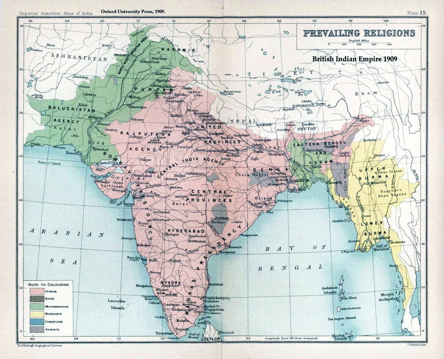
On a quiz, some students listed Burma, Nepal, and Sri Lanka as countries which emerged from British India, rather than the expected answer of India, Pakistan, and Bangladesh. Are these answers acceptable? According to this source (as well as many others), "British rule in Burma lasted from 1824 to 1948, Britain made Burma a province of India in 1886, and the British separated Burma Province from British India in 1937." Burma is therefore technically an acceptable answer. However, Nepal simply negotiated and allied itself with the British. It was never a British colony, although it was strongly influenced by the British. Sri Lanka, once known as Ceylon, was considered and administered separately from India, so it can not be said to have "emerged from India." Sorry!

Monday

"Blue Gold: World Water Wars" & "FLOW"

There is a documentary movie about water issues. It is called Blue Gold: World Water Wars. Here is the movie trailer.


Wars of the future will be fought over water as they are over oil today, as the source of human survival enters the global marketplace and political arena. Corporate giants, private investors, and corrupt governments vie for control of our dwindling supply, prompting protests, lawsuits, and revolutions from citizens fighting for the right to survive. Past civilizations have collapsed from poor water management. Can the human race survive?
Director Sam Bozzo
The movie was released in Japan in January 2010. You can order the DVD, or you could download the movie as a BitTorrent -- with the understanding of the director!

Another 2008 documentary, Flow: For the Love of Water, also discusses the same issues, focusing on the privatization of water. The film was on TV in Japan on November 1, 2009. DVDs are also available.

You can read more about the water crisis and water politics (also known as hydropolitics) in these Wikipedia articles, which give a useful overview.

We don't use water in only the obvious ways. It also takes a lot of water to make food and other things we use. If we consider this "virtual water," then Japan is one of the world's biggest water users, as this map shows. Here are some tips for saving water.

Saturday

Worldmapper

Worldmapper is an interesting site, especially for students, teachers, and people who are interested in the world. They have created about 700 maps which display information in a visual, map form. The sizes of countries are distorted to show various kinds of information in a proportional way. This map shows the number of elderly people in the country.
© Copyright 2006 SASI Group (University of Sheffield) and Mark Newman (University of Michigan).

Other maps show distribution patterns of food, goods, resources, work, income, wealth, health, education, poverty, violence, cause of death, age of death, communication, religion, language, and other measurable qualities. This site also allows you to download high-resolution images, PDFs, Excel or OpenDoc data spreadsheets, and other resources under a Creative Commons license.